Class 6 Geography Maps chapter 4 notes NCERT Solution in Hindi. NCERT Class 6 Geography Notes, Textual Question Answer and Important Question Answer also Available for Various Board Students like HBSE, CBSE, UP board, Mp Board, RBSE and some other State Boards.
Also Read:- Class 6 Geography NCERT Solution
NCERT Solution for Class 6 Geography Chapter 4 Maps Notes for students.
Maps Class 6 Geography Chapter 4 Notes
Map :- A map is a representation or a drawing of the earth’s surface or a part of it drawn on a flat surface according to a scale. When many maps are put together we get an atlas. Different types of maps are as :-
(i) Physical Maps :- Maps showing natural features of the earth such as mountains, plateaus, plains, rivers, oceans etc. are called physical or relief maps.
(ii) Political Maps :- Maps showing cities, towns and villages, and different countries and states of the world with their boundaries are called political maps.
(iii) Thematic Maps :- Maps that focus on specific information; such as road maps, rainfall maps, maps showing distribution of forests, industries etc. are known as thematic maps.
Components of Maps :- There are three Components of Maps – distance, direction and symbol.
(i) Distance :- Maps are drawn to reduce scales. Scale is the ration between the actual distance on the ground and the distance shown on the map. When large areas like continents or countries are to be shown on a paper, we use a small scale while to represent small area. on the map shows 500 km. of the ground. It is called a small scale map. we use large scale while to represent Larger area. on the map shows 500 metres only on the ground. It is called a large scale map.
(ii) Direction :- There are four major directions, North, South, East and West. They are cardinal directions while other four intermediate directions are north-east, south-east, south-west and north-west. Compass is an instrument used to find main directions. Its magnetic needle always points towards north-south direction.
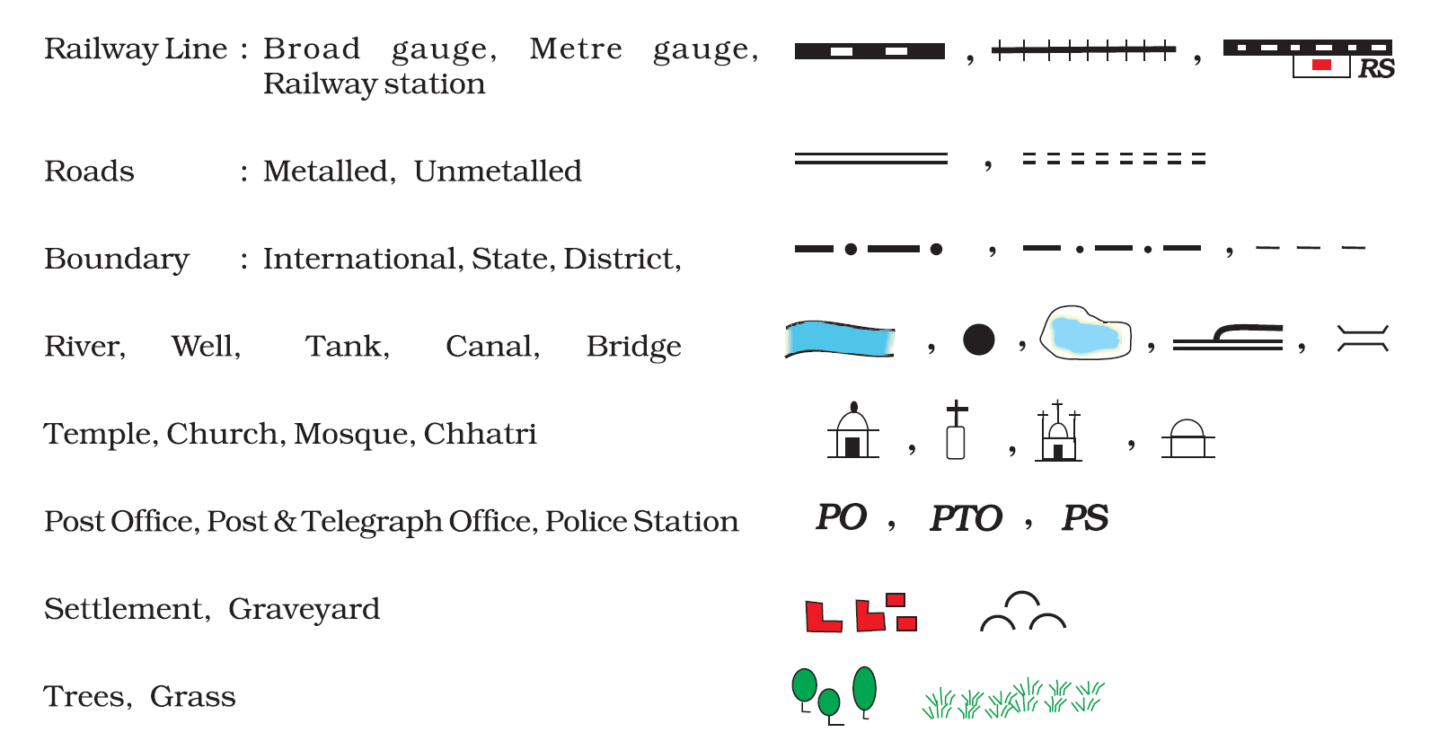
(iii) Symbols :- It is not possible to draw the actual shape and size of different features on a map such as buildings, roads ,bridges, trees, railway lines, or a well. So, they are shown using certain letters, shades, colors, pictures and line space. There is an international agreement regarding the use of these symbols. These are called conventional symbols. Different colors are also used for same. Generally blue is used for showing water bodies, brown of mountain, yellow for plateau and green is used for plains.
Sketch :- A sketch is a drawing mainly based on memory and spot observation. It is required to tell where a particular place is located with respect to other place.
Plan :- A plan is a drawing of a small area on a large scale. For example the length and breadth of a room, which can’t be shown in a map. At that time, we can refer drawings to scale called a plan.
Maps are more helpful than a globe :- A globe can be useful when we want to study the earth as a whole. But, when we want to study only a part of the earth, as about our country, states, districts, towns and villages, it is of little help. In such situation we use maps.